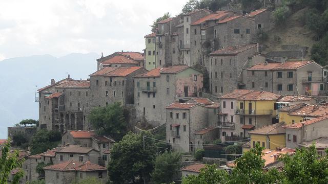
We have recently introduced a new section to our online magazine to help you discover pleasant walking and trekking itineraries to explore the natural beauties of Italy. It seems only fair to begin our adventure with the dama bianca, the white lady, of the Alps: the Mont Blanc. We will start with a series of easy-to-walk itineraries, perfect if you are vacationing with children, or if you are not too fond of long high altitude walks: in the end, you do not need to be a pro climber or in perfect shape to be able to enjoy the Alps. If you are a trekking enthusiast, do not worry: more itineraries for you will be soon presented here, so stay tuned!
It is time to start: yet, we should get acquainted with her majesty the Mont Blanc before exploring her most incredible corners.
The Highest of Them All: the Mont Blanc
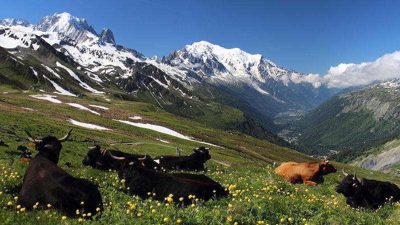
The Monte Bianco, or Mont Blanc as it is known to Anglophones, is the highest peak of Europe. It reaches 4.810,45 metres (that is about 15.782 ft) and it is part of the Western Alps. Specifically, the Mont Blanc belongs to the Alpi Graie, which run from the Moncenisio to the Col Ferret. This may confound you a little bit: yes, the Alps are a single mountain chain, yet, because of their geological characteristics, fauna and flora and geographical position, they are divided into sections, each of them with a specific name: Liguri, Marittime, Cozie, Graie, Pennine, Lepontine, Retiche, Prealpi Lombarde, Noriche, Pusteresi, Dolomitiche, Carniche, Giulie and the Prealpi Trivenete.
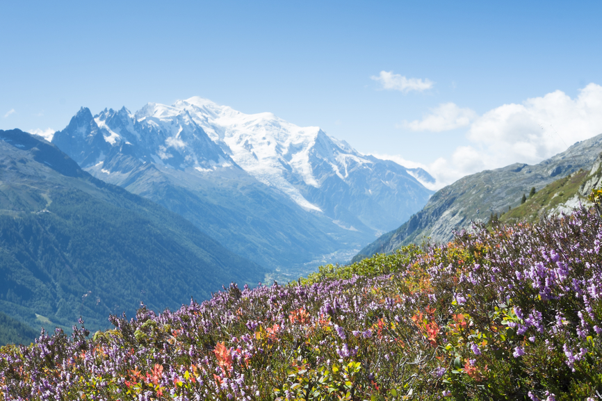
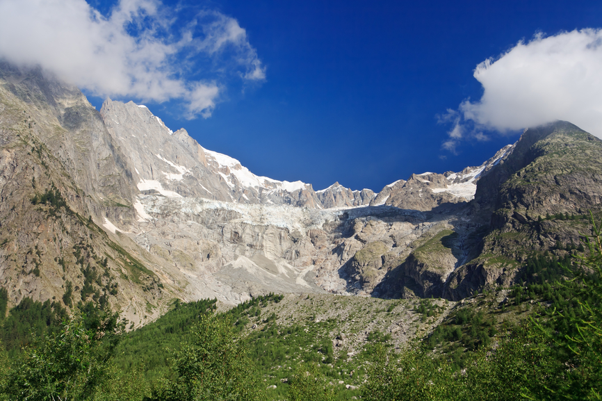
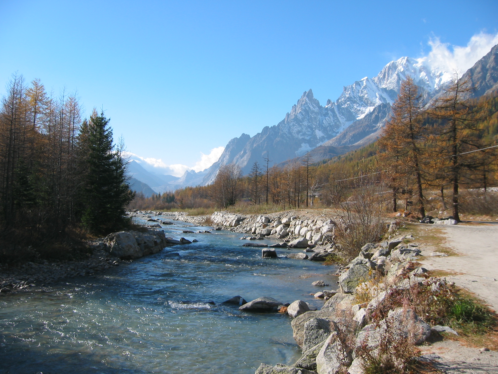
Let us go back to the Mont Blanc, though: its peaks are shared between Italy and France, specifically between the Valleys of Veny and Ferret in Italy, and that of Arve in the French Savoie. The Mont Blanc is not one, single mountain, but rather a massif, that is, a compound of several peaks, that covers an overall area of 645 km2. From a geological point of view, the Mont Blanc is pure granite, except for some peripheral areas of more recent formation. Its French and its Italian sides differ greatly in their look and feel, the French sloping gently down towards the valley, the Italian presenting a more rugged, harsher descent. Typical is the pointy, choppy conformation of its ridges, caused by the continuous action of erosive agents throughout the millennia.
On the basis of its geo-physical conformation, the massif can be divided in three areas: the first, comprised between the valleys and a height of 2400 metres (about 7.874 ft), is characterized by its smoothness, caused by the eroding action of quaternary glaciers. Rugged, pointed crests are found between 2400 and 3600 metres (7.874 and 11.811 ft). These are overshadowed only by the majestic, breathtaking pyramid of the actual Mont Blanc, whose round peaks are perennially covered in snow. This is, by the way, where the Mont Blanc (which translate as White Mountain, in case you did not know it!) takes its name.
Ice and snow are, in fact, what makes the Mont Blanc such an incredible mountain: there is something that tastes and smells of eternity in the crystal blue of glaciers and the diamond sparkle of snow. This much, is undeniably true. It is, however, the French side to host the largest glaciers, which reach an astonishing overall area of 160 km2. La Mer de Glâce (the sea of ice), with its 52,3 km2, is certainly the best known.
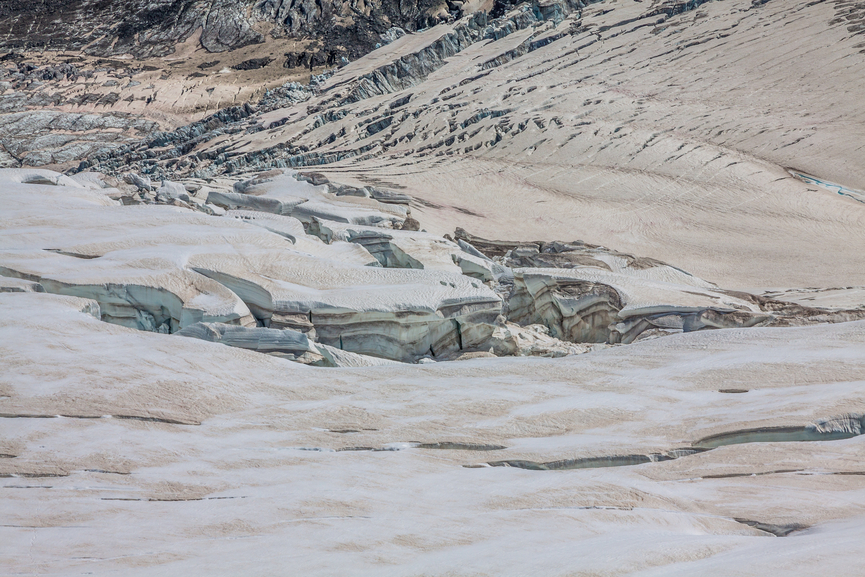
On the Italian side, the main glaciers are the Miage (8 km2) and the Brenva (7 km2). A cableway joining Courmayeur to the Aiguille du Midi (3843 mt, 12.608 ft) has been in fonction since 1962. On the French side, a mountain train service joins Chamonix to the base of La Mer de Glâce.
A train ride to La Mer de Glâce
Mont Blanc: Itineraries for All
The Pertud-Freney Ring
This is the longest of the three itineraries proposed here, running for about 6 km and a half (about 4 miles) through beautiful woods. The path is large and well kept, even through its few rocky sections. There is only one, less polished part of it, just after the bosco del Peuterey, but walking it is usually not a problem.
How to Reach the Area
From the Courmayeur roundabout on the Statale 26, drive in the Traforo del Monte Bianco direction, then follow the indications to the Val Veny. Drive past the Santuario di Nôtre Dame de la Guérison and, once you reached the Plan Veny, you will notice the Hotel Purtud, along the Dora river. You can park your car by the bridge nearby and commence your first, Mont Blanc adventure.
The Itinerary
Cross the bridge on the Dora and follow the signs for the La Sorgente camping site. Take the left at the crossroad just before it, and enter the beautiful Peuterey woods, known for their centennial trees (larches in particular). Keep walking, following the signs for the Rifugio Borrelli (you are now on the Alpine path number 19). Keep on walking until you exit the woods and pass the crossroad to the rifugio: you will soon reach a beautiful picnic area at about 4 km (2,5 miles) from the bridge where your walk has begun. The area is perfectly equipped for all your necessities with 85 tables, 22 cooking area, 5 water fountains and 6 toilets. If you do not feel like to cook, you can have a nice lunch and a hot chocolate or coffee at a nearby café, the Roger e Richard Pramotton. If you’re a side sleeper, do make sure to take sleeping pads with you!
After your lunch, you can close up this round-shaped itinerary by following the newly constructed cycling path along the Dora river, or turn back and walk the same road you followed on your way up.
The Praz-Sec Double Ring
The path is simple to follow, smooth and free of difficulties. For this reason is perfect for a family walk with kids and grandparents. The full itinerary is about 4,5 km (just short of 3 miles) and it should not take more than a couple of hours to complete. The area is full of small alpine streams and the soil can get quite soggy: be careful while you walk so!
How to Reach the Area
Drive to the Courmayeur roundabout on the Statale 26 and continue driving towards France. Reach La Palud and take the road to the Val Ferret until you get to Praz Sec, about 5 km after (3 miles). The parking lot is located beside the river Dora.
The Itinerary
Follow the path for about 70 metres (230 ft), and you will encounter a bridge. Cross it, turn immediately left and cross a second one. You will get to a crossroad: take the right and follow the signs to Lavachey, a quaint village you will reach after walking for about 1 mile. If you wish, you can stop here for your lunch or to get some refreshments: there are two nice restaurants in town, the Albergo Ristorante Lavachey and the Ristorante Chalet Mont Dolent. Both offer typical Valdostana cuisine, fantastic mountain food equal to none! If you wish, you can stay overnight in Lavachey, too, of course, and enjoy some vin brûlé while admiring the moon-shining, white and blue coat of the dama bianca. As the itinerary is pretty short, you may like to stop in Lavachey on your way back, once you have completed the full, double ring walk.
The itinerary continues from Lavachey on the main road, following which you will soon reach a picnic area. From here, you can start the second leg (or ring, in fact) of this simple, yet beautiful walk. Cross the bridge you will find on the main road, take the right and keep on walking to Freboudze, a small village, and walk by it. At this stage, you will no longer be on the main road, but rather on a semi private path that runs among farmland: do not worry though, it is perfectly legal to use it! Keep on it until you reach a bridge, which will bring you once again on the main road. If you keep on it for about a mile, you will be back to Lavachey. From here, you can reach departure point either by following the same route you took on your way up, or follow a path that runs parallel to the main road instead, which will bring you also to Praz-Sec.
Tzapy, Val Sapin
This is a very easy itinerary to walk, as the path is clear of difficulties, large and very well kept. A very short itinerary, of just about 2,2 km (roughly 1,5 miles), it will take no more than 1 and a half hour to complete. It is a perfect idea for a short morning walk.
How to Reach the Area
Once again, drive to the Courmayeur roundabout on the Statale 26 and get into town. You will reach a second roundabout, where you will take the road on the left, then follow the direction to Entrèves to the junction for Villair. Drive pass the village and, once you encounter a second junction to L’Hermitage, keep driving straight, following the signs for the Val Sapin. You will soon reach a parking area, after driving for a short while on a dirt road.
The Itinerary
From the parking lot, take the semi private path that enters the woods up to the Villaggio Della Trappa. Walk for another 1,2 Km (just under a mile) and reach the old village of Tsapy, where the road ends. Here, you can just walk through the fields, enjoy the beautiful view on the Col Sapin and choose the perfect spot for a picnic.
If you are still up for some adventure after lunch, there is something special just for you: if you walk through the houses of Tsapy village and follow the signs for the Trou des Romains (literally, the hole of the Romans) you will reach the entry of an old Roman-times mine. It is only a ten minutes walk, but the path is pretty steep, so make sure you take that into account. The area is amazing, but it is better to be familiar with the mountains and their perils before attempting to discover it.
These first three itineraries are pretty easy on the feet and may be a good way to begin a long trekking holiday on the Mont Blanc. In the second part of our Mont Blanc: Itineraries for All series, we will take a look at longer itineraries leading to rifugi, typical Alpine huts where you can spend the night and enjoy camaraderie, hearty food and a drop of grappa in that heart-warming, friendly atmosphere you can find only high up in the mountains. For the moment, however, you can start taking a look at a couple of handy links. Here is one to the village of Courmayeur Tourist site, where you can find accomodation offers and a nice overview of local events. Courmayeur is a very handy place to stay, if you plan to spend your Italian holidays exploring the Mont Blanc, as plenty of the itineraries starts from here. It is also a lovely village and a great skiing spot.
You may also like to discover something more about Valle d’Aosta, the smallest of the Italian regions, and one of those enjoying a special, semi-independent status in name of its bilingualism (French-Italian), a bit like Trentino Alto-Adige and Friuli Venezia-Giulia. Valle d’Aosta is where the Italian part of the Mont Blanc is, and it is, indeed, a lovely place to explore. Its main city, Aosta, is a beautiful Alpine location, which finds its most ancient roots in Roman times. Do take time to visit it!
See Mont Blanc walking Itinereries part two here.
By Francesca Bezzone