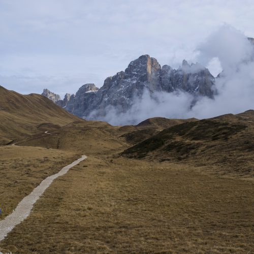
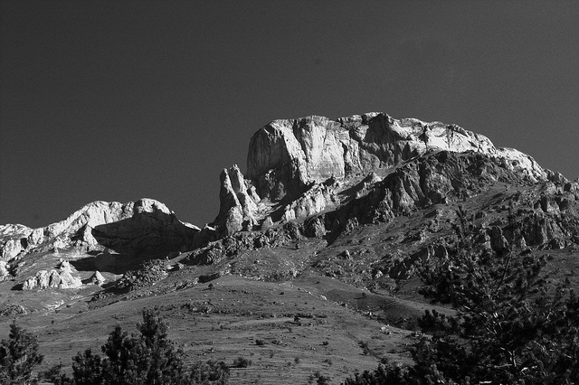
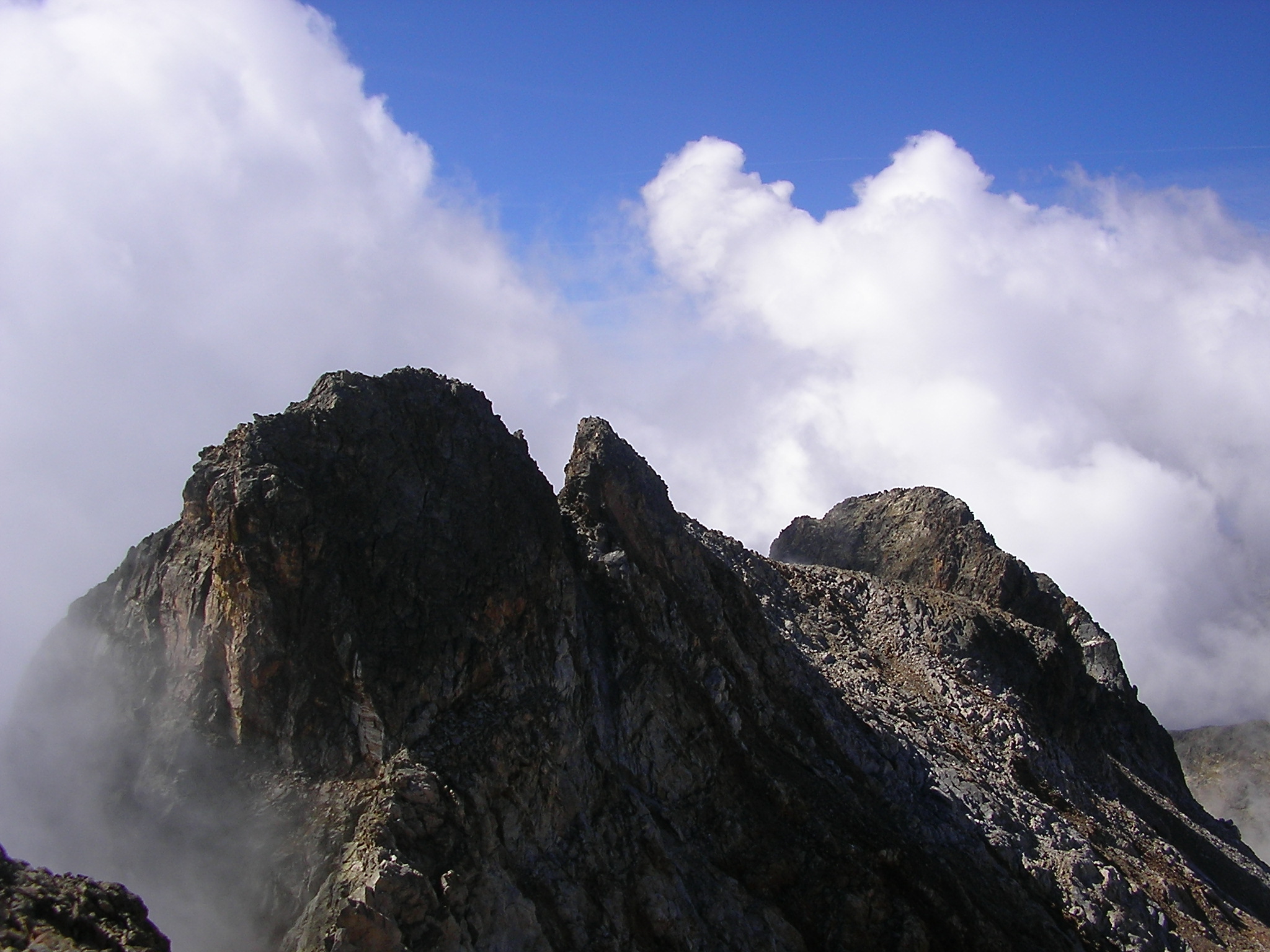
The beauty and history of the Alpi Marittime
Maritimes (guidosky/flickr)
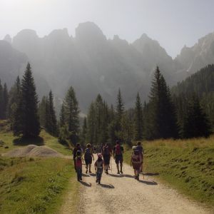
If you enjoy trekking, you must have liked our first couple of articles on the walking itineraries of the Alps.
We learned about some beautiful itineraries on the Mont Blanc characterized by, beside the beauty of the area, their easiness. The itineraries proposed in this article may be slightly more challenging from a physical point of view, but they will bring you through some of the most enchanting areas of the western Italian Alps. These are itineraries steeped in history and culture: they will lead you through the times and places of the early decades of the history of unified Italy, when the Savoia family made of the Alpi Marittime their favorite retreat. You will walk the paths and “mulattiere” of the Alpini, courageous guarantors of the kingdom’s mountaineous borders since its very birth, who fought two wars on these mountains and built many of their roads.
I must admit this is a special article to write: I grew up walking up and down the paths and “mulattiere” of the Alpi Marittime and Liguri, a favored destination throughout the Summers of my childhood. I lived my entire life with them just there, outside my window, shadows of malachite green in the hot season, diamond white in the Winter.
When I left Italy and moved abroad, it took me two years to realize I ached for the presence of those mountains and I am not afraid of admitting, in a poetical afflatus only a short step away from melodrama, I needed to come back to them and I am glad I did.
I am also the grandchild of an Alpino of the Cuneense, who loved those mountains passionately and who, along with his comrades, helped building the same paths you may walk upon, if you decide to make the Marittime yours for a few days.
If you pay attention while walking, especially in some areas of the Valle Gesso, one of the two main valleys of the Marittime, you may come across the name “Divisione Alpina Cuneense” roughly carved on large stones along the roads: that means it was them who dug, walked, carved the rocks around and created a way for us to walk through beauty. Of course, that is what we do today, but to them, it was more of a military affair, as better communication meant the army was able to provide better protection to the Alpine borders of the Kingdom of Italy.
Think of these men, while you walk through the Marittime, as most of them were to fight on one of the most horrific, bleak and terrifying war fronts of the Second World Conflict: the Russian front. Many of them never returned to these valleys they so dearly loved, nor to their families and still today, more than 70 years on, our mountain and high hills villages grieve for the loss of almost an entire generation of men. My grandfather also never returned and I am today, still very much young, in my mid-thirties, 9 years older than he was when he left home never to return.
Therefore here, on these peaks, where nature leaves Man speechless, we must bow our heads down to history, too. And to the people who, silently and leaving only a rough mark carved in stone, truly made it, maybe more than those we study on our history books.
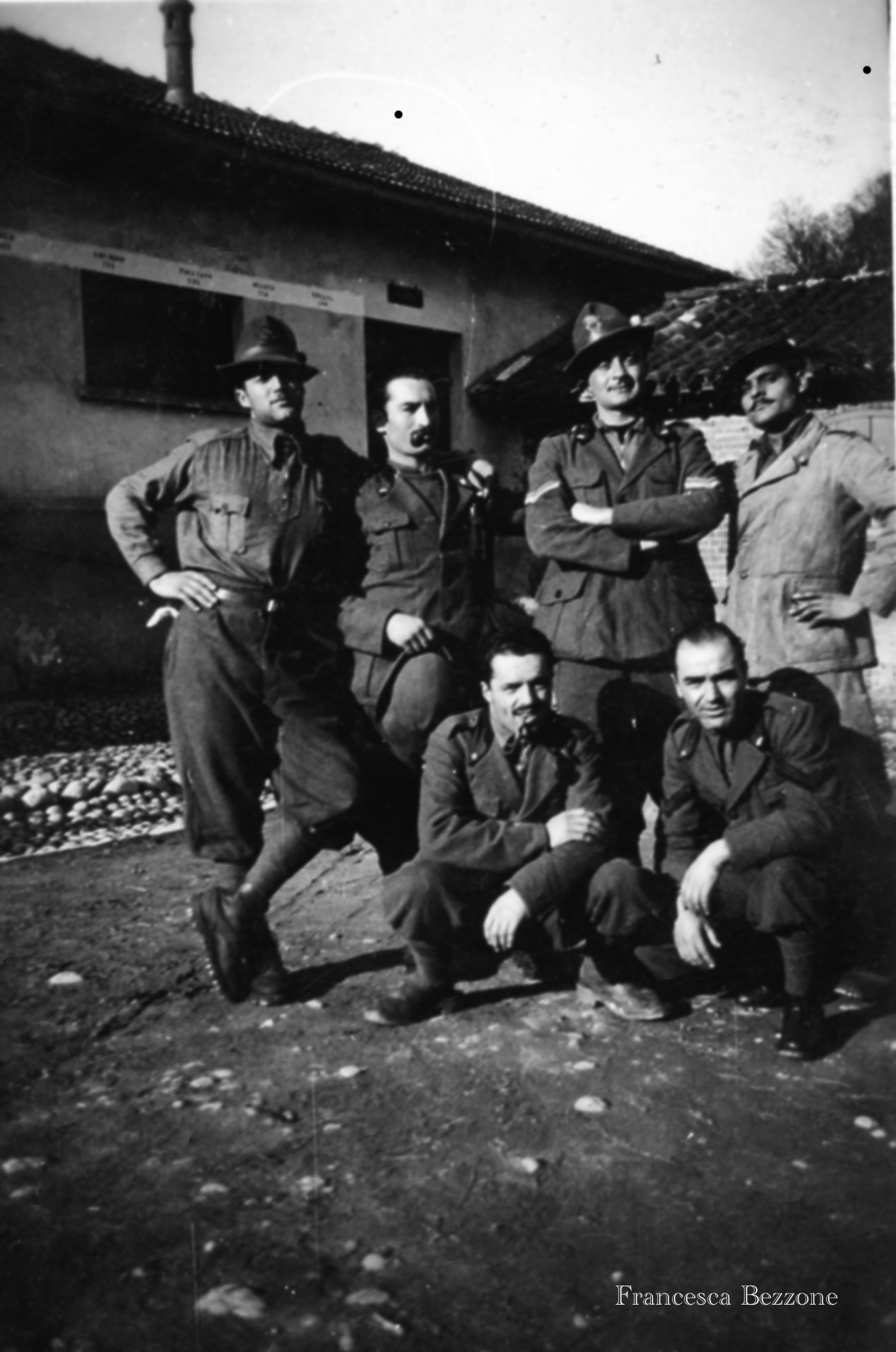
my grandfather on the bottom right (Francesca Bezzone)
The Itineraries
The itineraries presented in this articles have two things in common: the area, of course, and the fact their creation, or the places they lead to, have historical relevance.
The first series of itineraries will lead us on the path of Italian soldiers of the Second World War: we will walk on the roads they built and visit the fortifications they created. A true piece of contemporary history just there under your feet, surrounded by the timeless majesty of the mountains.
The second, to the Rifugio del Valasco, once a Savoia’s hunting lodge: an easy itinerary, perfect for the whole family, with the added advantage you could stay in the rifugio for a few days and enjoy its amazing surroundings for a while.
Our last proposed itinerary is, in fact, suggested by the Parco delle Alpi Marittime‘s people themselves and is organized throughout the Summer: the Itinerario dell’Alta Valle dei Re will see you trekking for a whole week, during which you will learn to know and love the valleys of the Marittime and have the opportunity to enjoy some true Alpine life, while staying overnight in rifugi and hunting lodges.
The Marittime and the Military
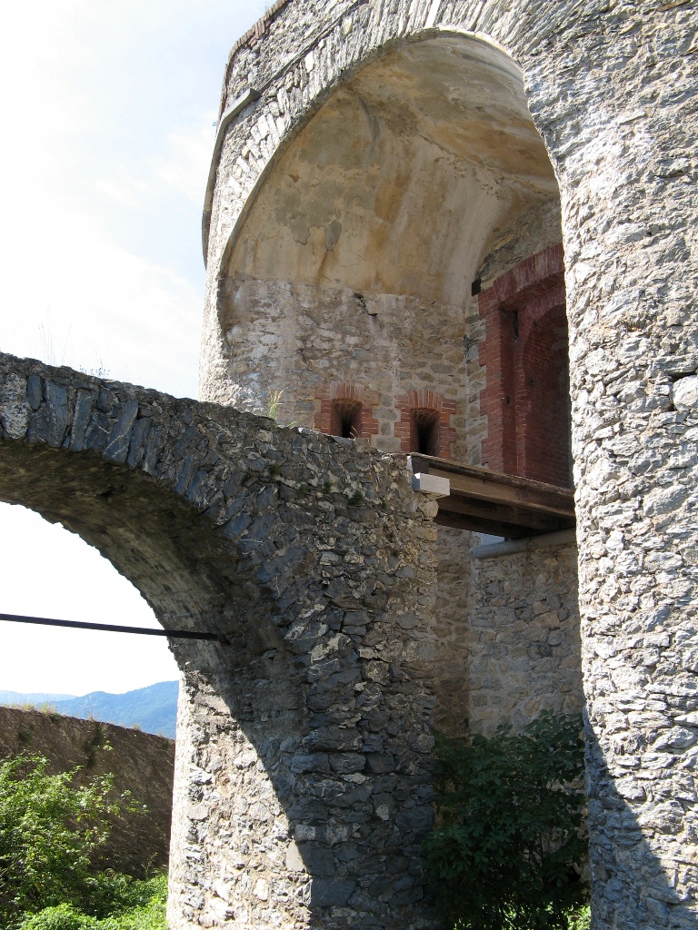
Silent witnesses to the history of Italy, the Alpi Marittime still carry upon their shoulders signs and symbols of the past. A natural defense against invasions, it was only natural to see fortresses and military barracks grow in number and size along their sides.
These remain, truly, some of the most fascinating historical sites in the area to visit, especially if you are interested in military history. Most of the forts and military compounds touched by the itineraries below were built before the last war, some of them even before Italy became a unified country, but were also used during the Second World War, albeit briefly, as the war against France lasted barely 15 days: in fact, it is simply called a “battle,” rather than a war.
The military, and the Alpini Corps in particular, however, have profoundly shaped these mountains, not only because so many of them were born here, but also because many of the itineraries and walking ways crisscrossing the Marittime were built by them: the Alpini were created as soon as Italy became a country, with the specific aim to protect our Alpine borders. They were considered the strongest of our soldiers, because trained to fight, resist and live in the asperity of the mountains. Proof is that, for instance, it was them to fight in the unimaginable horror of the north eastern trenches of the First World War, and it was, once again, them who walked their way through the ices of the Russian steps around the Don river in the Second.
But in times of peace, they had been employed to improve viability on the Alps (all of them, not only the Marittime!) and their skillfully built “mulattiere” (large stone or dirt roads, created to ease transport by mules, mulo, in Italian, from which mulattiera).
Buildings, routes and roads of the War, history to be breathed in and contemplated, thinking also of the men who made it.
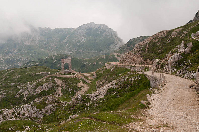
Itinerary One: The forts of the Marittime
The Forti di Nava as we know them today were built in the second half of the 19th century, with the aim of protecting Piedmont from French invasions, military fortifications were already present at the times of Napoleaon.
Location is crucial because it still is one of the main Alpine passes connecting Liguria and Piedmont and, in the past, it was one of the easiest ways to reach Italy from France.
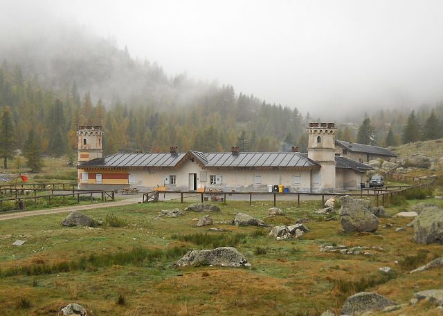
The itinerary, which touches all five forts, begins from the square opposite the Forte Centrale, in the small village of Nava. Nava has a great relevance for the Alpini Corps, too, as a military memorial dedicated to them is located here.
To reach Nava from Turin, the largest city nearby, which is also served by an airport, you should take the A6 motorway Torino-Savona in the Savona direction, exit at Ceva and there take the SS 28 to Ormea. Once there (Ormea is a quaint little Alpine village, you may enjoy spend a day there), follow indications to Ponte di Nava and then Colle di Nava, where the village is.
The Forte Centrale is the first, easy to reach stop of this itinerary, which should take you between 3 and 4 hours to complete for a total of 20 km (12 1/2 miles). The Forte Centrale is visitable, too, if you travel there during the Summer months: in June and September, on Saturday and Sunday mornings. In July and August from Tuesday to Sunday 10-12 and 14-19.
After your visit, you can begin the itinerary propers: a short walk will lead you to Forte Bellarasco, from where the dirt road begins. Follow the main path until you reach a crossroad, then take the left path: here, the real ascent starts. Follow the “NAVA B” path (it is pretty steep, but do not worry, it is not long!) up to an hazelnut grove, shortly after which you will get to the third fort, Forte Richermo: the view from here is absolutely marvellous, spacing over the Marittime and the Colle di Nava, standing now below you.
A downhill walk back towards Nava will give your heart and feet some respite, but be ready to walk high up again. Once you reach Nava, follow directions to Monesi, up to a crossroad; here, turn right and keep following the directions for the forth fort, Forte Montescio. From now on, your walk is all downhill: turn back onto the road you came from and follow it to the crossroad. Here, you will also encounter a dirt road, which will bring you to Forte Pozzanghi. A beautifully pleasant descent will lead you, from here, to the square of the Forte Centrale and to the end of this itinerary.
Le mulattiere degli Alpini
We had the opportunity to mention how the Alps had been considered, even before the unity of Italy, a key, strategic defense point for the Northern borders of the peninsula. After unification, and especially after the stipulation of the Triple Alliance, created in 1882 between Germany, Austria and Italy, it became paramount to strengthen Italy’s western borders in particular, as they were shared with a country, France, unfriendly to the Alliance.
The amelioration of comunication and viability was at the basis of a successful process of increased defense: better roads joining passes and mountain peaks, or forts to forts, were essential to allow a quick and safe passage of troops and supplies. Real roads, in many cases, needed to be created, to allow for the movement of equipments and weapons, which were too heavy to be carried by soldiers and needed to be transported by mules.
This is the main reason behind the birth of the Alpine mulattiere on the Marittime, even though, one must admit it, works had started already after Vittorio Emanuele II had made of the Valle Gesso his own private hunting territory (more of it in the second part of our article!).
These roads served military purposes up to the end of the Second World War, then became regular trekking routes we all, today, have the pleasure to enjoy. Not often, unfortunately, we stop to think about the skills, expertise and labor behind their creation: not only they are wide and, in many cases, paved, but they are easy to walk, their incline never too steep. And in the end, tracing a mountain road was not a simple affair: one had to keep in mind the natural geology of the terrain. The presence of the wind, its direction and how to avoid it. The road had to be placed in a relatively sunny area, too, so that snow towing could happen quickly.
The “mulattiere” and roads created by the Alpini between the end of the 19th and the first 40 years of the 20th century are amazing engineering feats, as well as a monument to the work and dedition of an army. For this reason, walking upon them is truly like walking through history.
Itinerary two: Rifugio Emilio Questa and the Laghi di Valscura
This is a beautiful trekking ring starting from Terme di Valdieri, which will give you the opportunity to experience one of the most popular itineraries created by the Alpini corps and enjoy the beauty of your surroundings all at once. A classic itinerary of the Maritimes, it will lead you to some of the most suggestive spots in the area, from the Pian del Valasco, where the Rifugio del Valasco is (you’ll get to know more about in the second part of our chat on the historical itineraries of the Maritimes), to the stunning lakes of Valscura and Claus.
The itinerary runs through the Monte Matto, one of the main mountains of the Marittime.
Starting point of the walk is the little chapel of San Giovanni, in Terme di Valdieri: take the large military “mulattiera” that runs by the eliport and enters the Valasco Valley. Pass the rio Cougné stream and, once you encouter the next crossroad, take the left: from here on, you will be walking on shortcuts to the main road, always created by Italian soldiers in the last century: enjoy the view, because it is breathtaking, with plenty of idyllic, small waterfalls and crystal clear streams.
Just before the Rifugio del Valasco, you will get back onto the main “mulattiera” and reach the Piano Superiore del Valasco, at 1814 metres above sea level (about 6000 ft). Cross the river Gesso (from which the valley takes its name) and keep on walking on the military road up to a large (dead!) larch, at about 2000 metres above sea level. Here, another “mulattiera”, the Valscura-Fremamorta, will lead you to the rifugio Questa.
From here, you could continue the walk on a partially paved “mulattiera” and reach the lago Claus first, at 2344 metres above sea level, and the lower lago di Valscura, at 2274. Keep walking downhill and, around 2100 metres above sea level, you will find a crossroad: take the right and enjoy a scenic shortcut through the mountains, which will lead you back to the large, dried lark mentioned above. From here, follow the same route as before to reach Terme di Valdieri.
In the second part of our historical itineraries of the Alpi Marittime article, we will take a look at a Savoia inspired itinerary, a week long, guided tour of the Marittime steeped in history.
Francesca Bezzone